4th Place: WorldClim

- Pros: easy to use; resolution ~ 1km; global coverage; most widely used & therefore limitations recognized/known.
- Cons: Some more regional sources below are thought have greater accuracy (more local weather stations).

- Pros: easy to use; resolution ~ 800m; well trusted & used by big gov agencies USGS, NOAA ect; multiple time periods available; custom orders possible for time periods, resolutions & unique variables; LIVE climate data.
- Cons: USA only; basic data free, but have to pay for special custom orders.
2nd Place: ClimateWNA ready from UofA Hamann's lab webpage
- Pros: easy to use; high resolution ~ 1km; all benefits of ClimateWNA (see associated documents).
- Cons: Projected as LCC & have to reproject data; one time period; 1km res might be problematic in steep terrain?
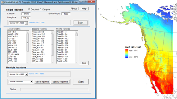
- Pros: Its also possible with ClimateWNA to produce climate raster grids by sending the program DEMs as a text file to make any climate variable at any resolution in North America.
- Cons: Up to the user to decide appropriate resolution (e.g. climate grids generated at 5m resolution give false precision and are not necessarily more accurate).
No comments:
Post a Comment